Not in Brunet, Graesse, or any other specialized consulted bibliography.
First edition, very rare, most likely published at the author’s cost
Louis de Froidour (ca. 1630-1680), lieutenant of eaux-et-forêts in 1651, was appointed Commissaire réformateur by Colbert in 1666. His task was the general reform of the waters and forests in order to develop the royal navy. His field of action was the Toulouse region, where he had to improve the yield of the forests by breaking with local rights that allowed the inhabitants to use firewood and timber freely. To build ships for the navy, a means of transport had to be found. This is how Froidour explains the project to build a large lock at the Naurouze culmination, which for a time was part of the great Canal de Midi project led by the famous architect Pierre-Paul Riquet (1609-1680).
“The Naurouze sill is a strategic point on the Canal du Midi, separating the Atlantic and Mediterranean sides. Pierre-Paul Riquet invented an ingenious hydraulic system that fed this highest point of the canal. Before him, all projects to build a canal between Toulouse and the Mediterranean had failed: they had all come up against the impossibility of getting enough water to the Col de Naurouze. Located on the border between the departments of Haute-Garonne and Aude, the Naurouze sill is also known as the “watershed”. It is the key site of the Canal du Midi, historically, technically and architecturally” (see website of Canal du midi).
The French National Library lists only 5 works from the presses of Jean-Dominque Camusat in Toulouse between 1672 and 1701, the first of which was this study by Froidour on the Naurouze lock.
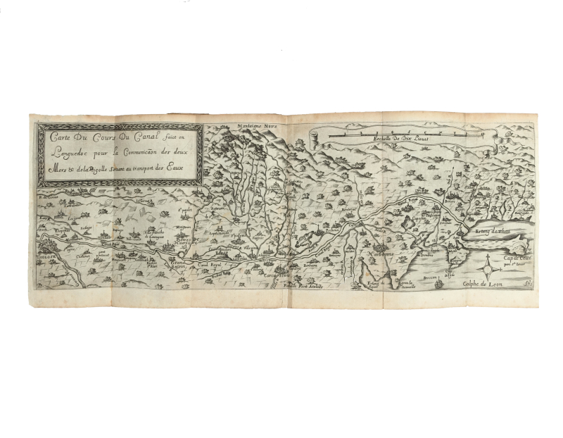
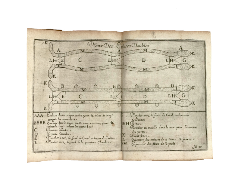
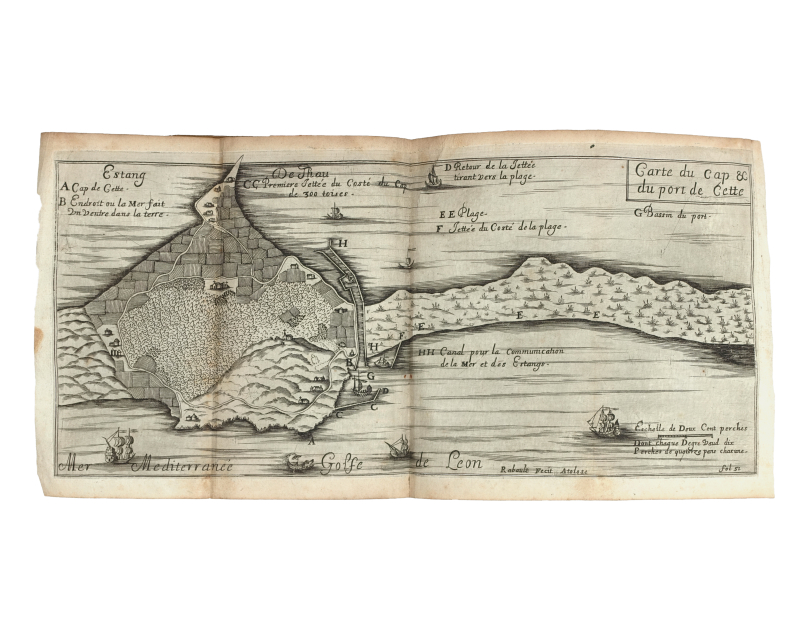
The beautiful engravings show 2 maps and 9 plans. The large map is entitled Carte du cours du canal faict en Languedoc pour la communication des deux mers & de la Prigolle servant au transport des eaux. This very detailed map shows the course of the Royal Canal from the Etang de Thau via Naurouze to Toulouse. A second map shows the port of Cette. The 9 plans contain construction details for the basins and the lock, whose oval shape is noteworthy.
Small tear (without loss) to the large map, otherwise a very fine copy of this rare provincial publication.
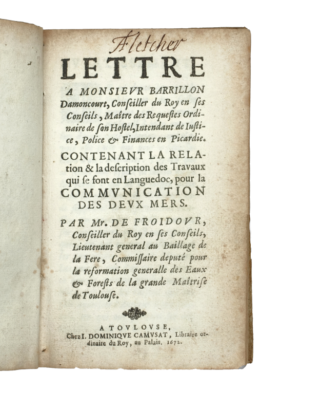
Provenance : A[ndrew] Fletcher (signature on the title). Andrew Fletcher de Saltoun (1655-1716) was a Scottish writer and politician. A zealous member of the Scottish Parliament, he fought successively against the governments of Charles II, James II and William III. His library was reputed to be the best library in private hands in Scotland.