Palau 138584 ; Sabin 41373 ; John Carter Brown Library, III, p. 271 ; The Hill collection of Pacific voyages 1025 (1598) : “Lisnchoten’s work, along with Hakluyt’s, served as a direct stimulus to the building of the vast English and Dutch overseas empires”.
rare french edition of “this inestimable book, a treasure of all the learning respecting the East and West Indies” (Sabin). The Histoire de la navigation aux Indes orientales is one of the most important early travel books, apparently used by ships sailing to India from Holland. It includes accurate sailing directions to the East Indies and many translations of Spanish and Portuguese documents on geography.
By publishing these forbidden data (routes and maps), Linschoten provided the Dutch and English with practical keys to eastern navigation, which led to the commercial expansion of the Dutch East India Company (VOC).
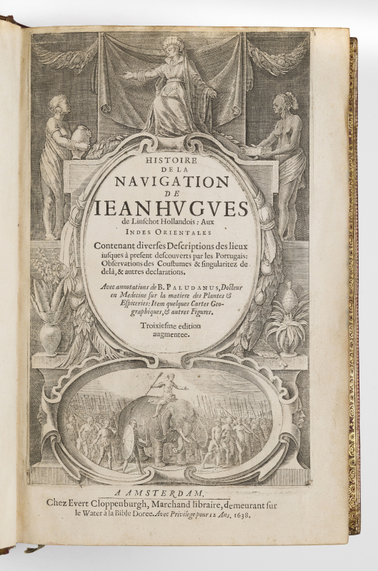
Third edition in French of this famous guide to navigation to the Indies, which is at once a navigation manual, a geopolitical treatise and an atlas.
It reproduces exactly the composition established for the second French edition published in Amsterdam in 1619 (the first having been published in 1610).
Divided into three parts, the work is based on a corpus of original Spanish and Portuguese documents devoted to geography, ethnography, statistics, and navigation. The text, which combines this scattered knowledge with the author’s personal experience, is enriched with comments in italics by Bernardus Paludanus.
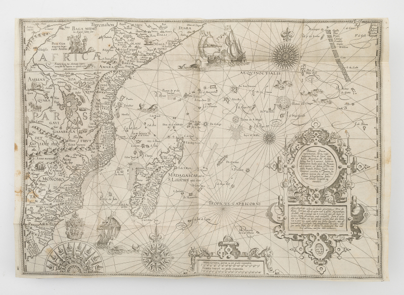
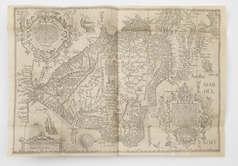
The first part is devoted to the East Indies and Africa, with additional information on China and Japan; the second part deals with the coasts of West Africa, from the Cape of Good Hope to Arabia; and the third part covers North America, including Florida, the Caribbean and Brazil.
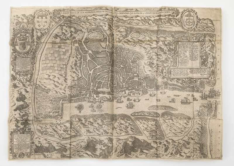
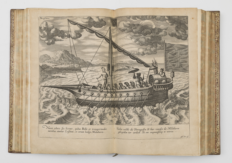
It was during his long stay in Goa (1583-1589) — as secretary to the Portuguese archbishop Dom Vicente da Fonseca — that Jean Hugues de Linschot or Jan Huyghen van Linschoten (1563-1611) discovered the caste system and social customs of India, as well as its flora and fauna. Above all, he gathered information previously kept by the Portuguese concerning sea routes, ports, currents and maps.
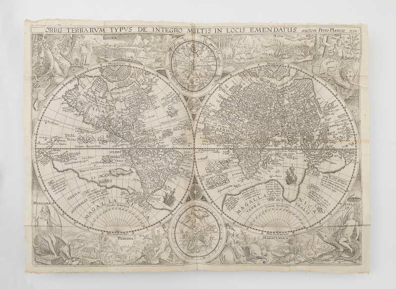
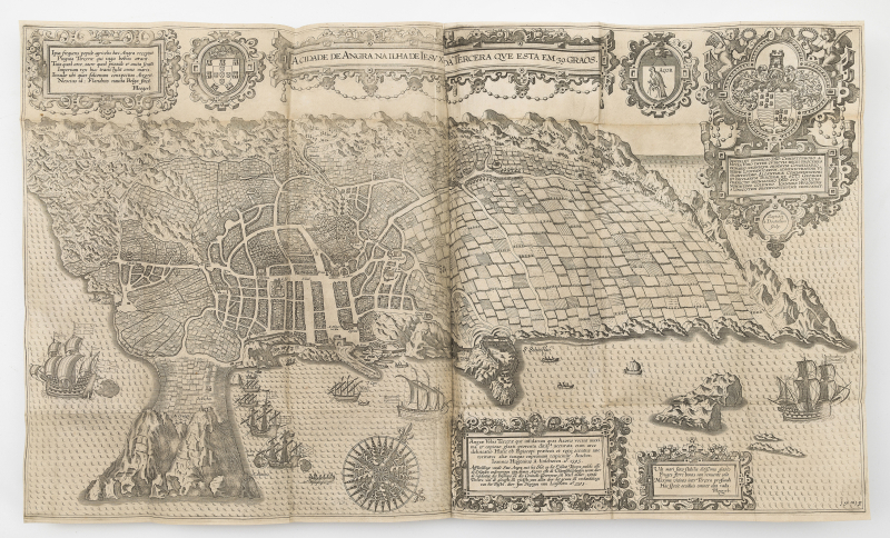
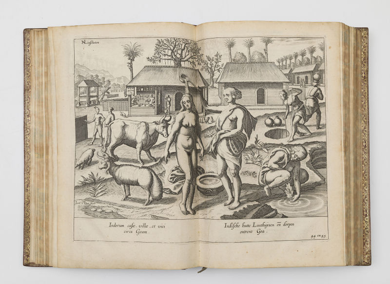
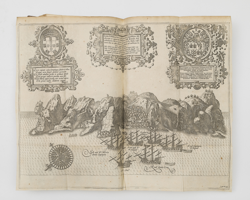
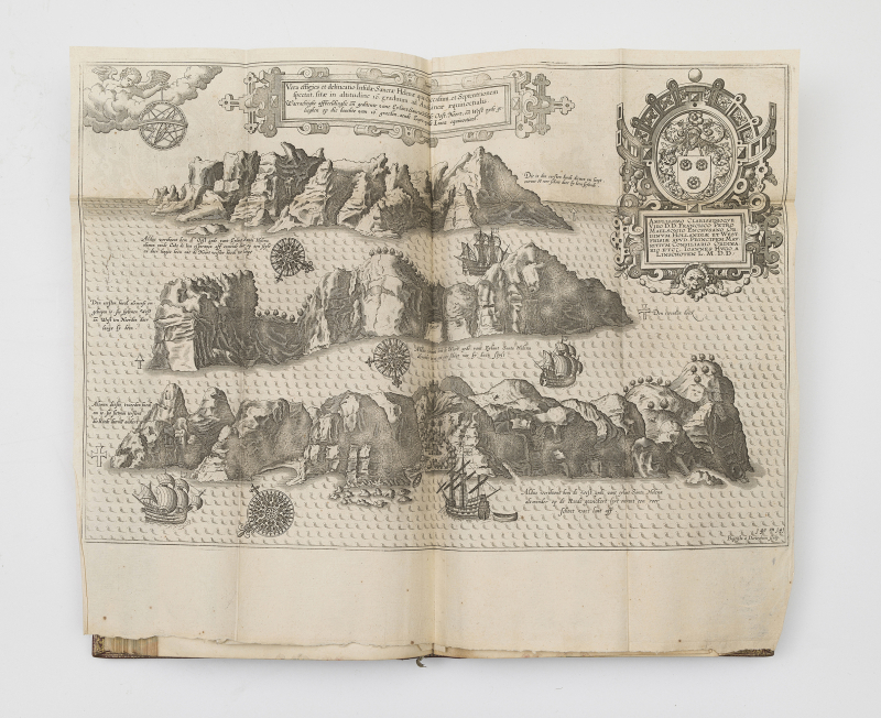
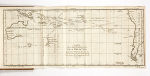
This edition retains the illustrations from the original Dutch edition of 1596: six maps—five in the first part and one in the third—as well as the 36 beautiful plates inserted in the first part: types and costumes, scenes of daily life, flora, and maps, notably of Goa and Angra.
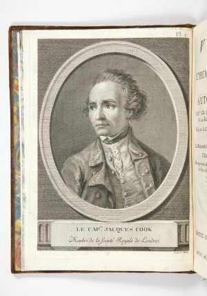
The illustrations also include an engraved title, repeated for parts I and II, an engraved portrait of Jan Huygen van Linschoten, and an engraved vignette at the title of the third part.
A reference work since its original publication, this guide was widely distributed among sailors travelling to India. Intensively used, it rarely survived intact; and copies with all their plates and maps intact have become rare.
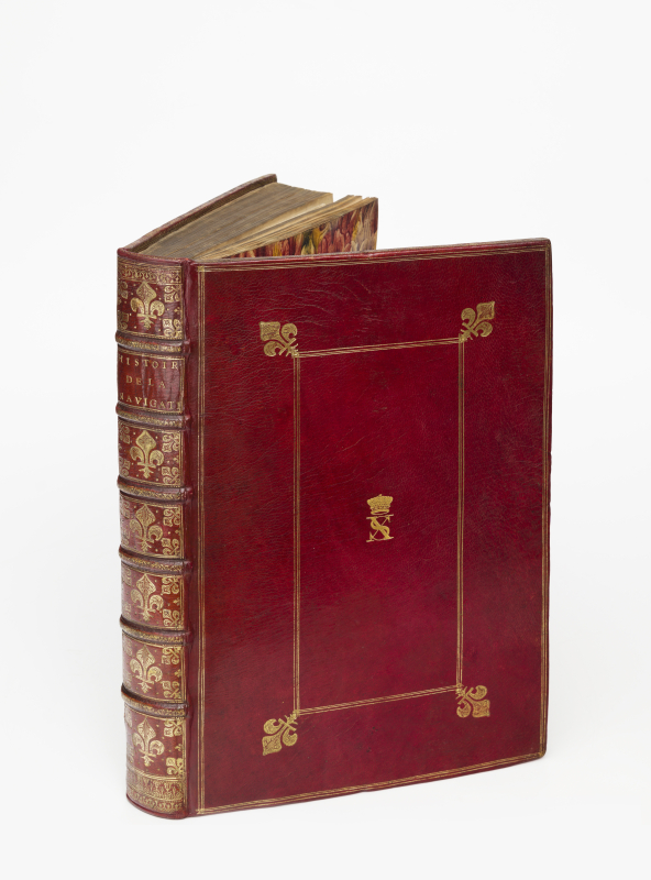
Luxuriously bound, probably for a great bibliophile of the 17th century, this copy later became part of the collection of the 5th Earl of Essex, George Capell-Coningsby (1757-1839), with his crowned monogram SX in gold on the front cover. A lord and member of parliament, he was responsible for renovating the family home of Cassiobury House (in Watford, Hertfordshire, England), which contained the extensive library maintained by the family and for which a sales catalogue was compiled in 1896, Catalogue of the library in the possession of the Earl of Essex at Cassiobury Park.
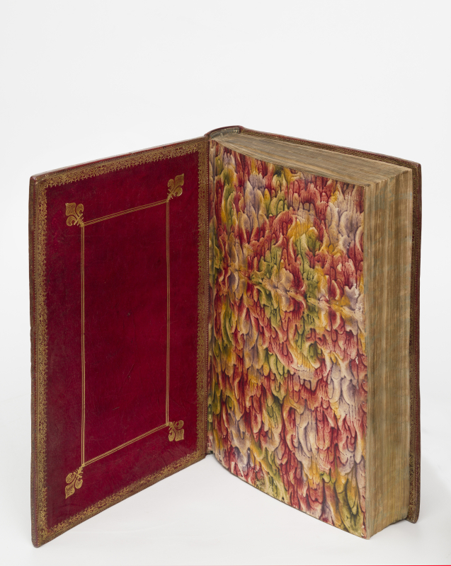
Guard of the Africa map on p. 6 detached; f.D3, pl. ‘48 in 49’, title of the second part: minor marginal tears with no loss; small tear at a fold on the large map of Goa; pl. ‘142 in 143’, faint stain; foxing on sections A to G of the second part; a few stains. Slight rubbing to the binding (cuts, joints, spines), and small black stains.
A magnificent copy, certainly the nicest extant, luxuriously bound for a great 17th century bibliophile in gilt fleur-de-lis-patterned red morocco.