Sabin, 8388; O’Reilly, 93; Hill, 190.
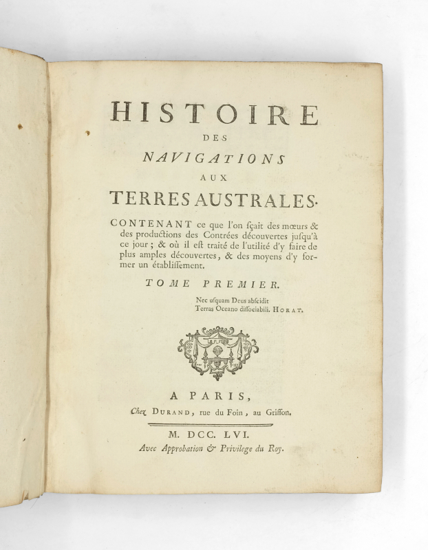
First edition, second and best issue, illustrated with 7 foilding maps.
It is the best work on the South Seas in the mid-eighteenth century: de Brosses summarises the various accounts of travellers, which he quotes extensively, from Vespucci’s second voyage in 1502 to the voyages of Magellan, Drake, Schouten, Tasman, etc.
‘His study marks a milestone in the knowledge of Oceania (…) de Brosses… beat the drum of scholars around the Southern Lands and helped to create a favourable climate for scientific exploration and colonial settlements. His work is of capital importance for the early history of Oceania’ (O’Reilly). Second edition, preferable to the first, published the same year without illustrations, whereas this one contains 7 large maps. O’Reilly states: ‘Two editions. The first without maps and without errata. The second, with 7 folded maps and an errata’.
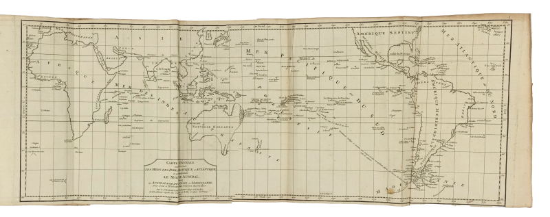
“This is an extremely important and thorough collection of voyages, and one of the outstanding works relating to the early history of Australasia. It contains an account of all voyages, beginning with the second expedition of Vespucci in 1502 and ending in 1747, in which navigators touched upon the supposed southern continent of Magellania, which is now represented by Australia and some scattered islands in the Antarctic regions. It also contains the voyages of Magellan, Drake, Hawkins, the Nodals, Schouten, Tasman, and others. Seven interesting maps, done by Sur Robert de Vaugondy of the Académie Royale des Sciences et Belles Lettres de Nancy, are inserted at the end of the second volume. The work, originally published anonymously, is divided into three principal parts – Magellanie, Australasie, and Polynesie – and is of special importance because in it de Brosses proposes that France should settle Australia with her foundlings, beggars, and criminals” (Hill).
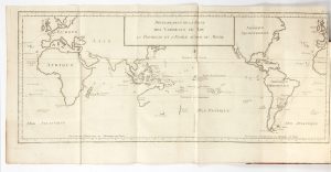
The seven beautiful numbered maps show: 1. General map showing the Indian, Pacific and Atlantic seas and mainly the southern world. 2. Reduced map of Southern Polynesia. 3. Map of the Strait of Magellan and the Falkland Islands. 4. Reduced map of Australasia. 5. Part of Australasia which includes the land of the Papuans or New Guinea, and New Britain. 6. Map of the Papuan Islands. 7. Maps of the Caroline Islands.
Copy complete with pages 437* to 450* in the first volume devoted to the ‘Discoveries of the Dutch in Australasia’, which are often missing; as well as the errata (4pp. for volume I, and 2pp. for volume II).
A very good copy, volume I pp. 237/238 torn with no loss.